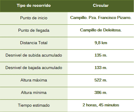
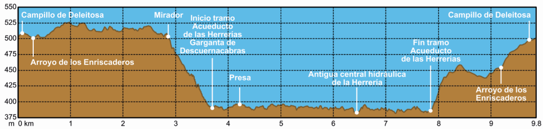
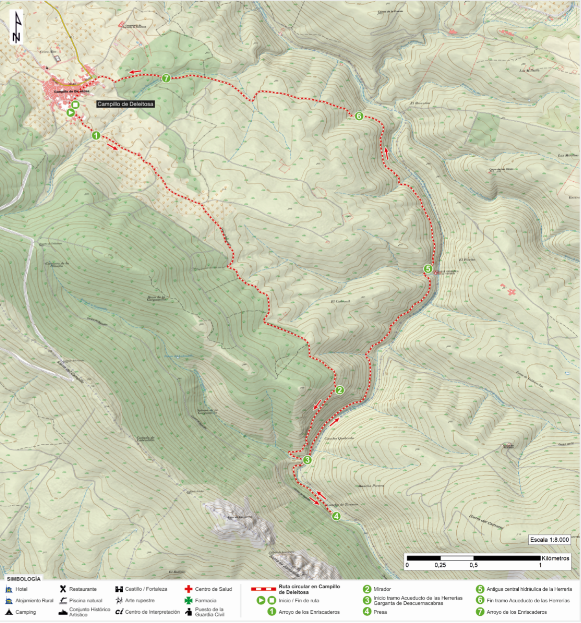
The route begins at Plaza Francisco Pizarro, leaving the town to the south and crossing the Los Enriscaderos stream.
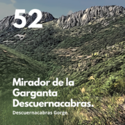
The route follows the path to Robledollano, passing small family-owned olive groves before descending toward the Descuernacabras Gorge—a descent made via a steep but technically easy trail. Along the way down, there is a viewpoint offering vistas of the gorge, the *Herrerías* (ironworks) canal, the ruins of mining operations in the distance, and outcrops of greywacke—the most abundant rock type in the landscape. It is also an excellent spot for birdwatching.
Once at the canal, you can take a walk to the right toward the dam, enjoying the riparian forest. The vegetation is diverse, featuring ash and Portuguese laurel alongside alder and willow trees. You may also spot elderberry, wild olive, strawberry tree, laurustinus, and terebinth along the path leading to the dam.
Retracing our steps, we begin the aqueduct section—a unique experience as the path runs inside the canal itself. This allows for a close-up view of the greywacke outcrops and fossilized wave ripples. Continuing along the canal—which runs parallel to the Descuernacabras Gorge—we soon spot the old *Herrería* hydroelectric plant. From there, we head north, leaving the canal via a path to the left and taking an uphill track heading west; this leads back to Campillo de Deleitosa and the end of the route, following a final crossing of the Enriscaderos stream.
The *Herrerías* Aqueduct is an old hydraulic structure that transports water from a dam located at the confluence of three gorges. It once supplied water to an ironworks and three small hydroelectric power plants.
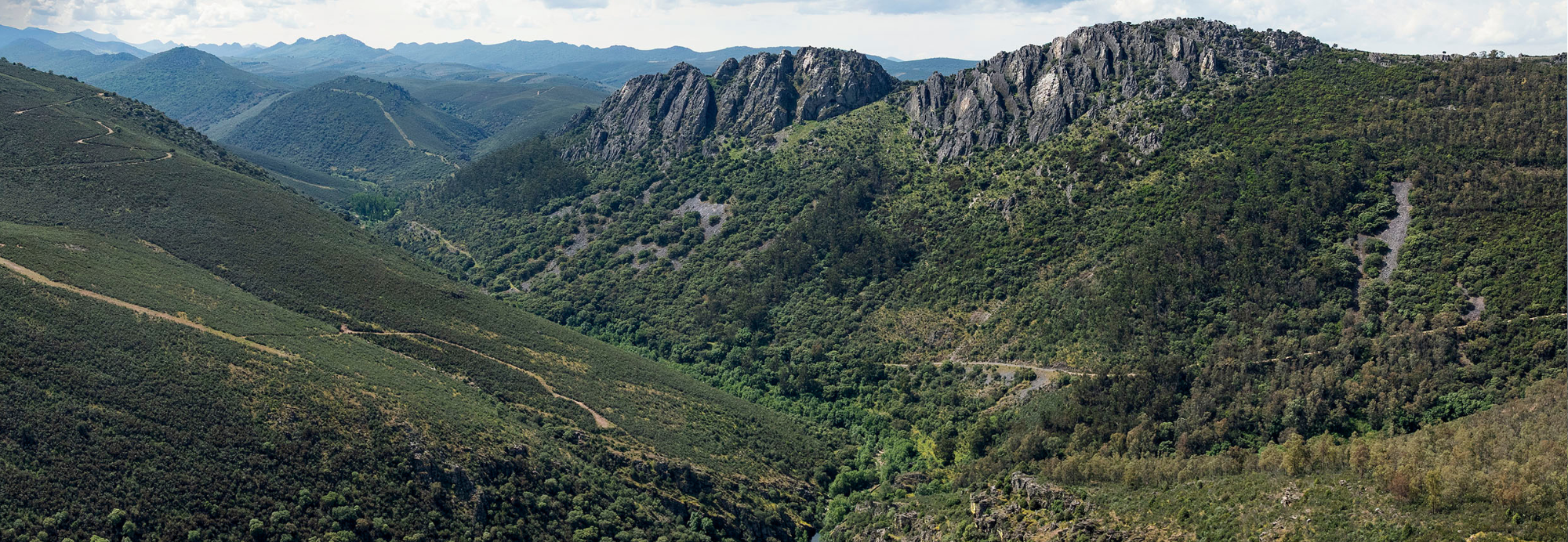
Geologically, the area belongs to the Central Iberian Zone of the Iberian Massif, specifically within the Montes de Toledo and the Las Villuercas massif. The predominant rocks along the route are shales, slates, and greywackes from the Domo-Extremeño Group (Ediacaran period, approximately 600 million years old), interspersed with some micro-conglomerate layers. From the viewpoint, you can observe the contrast between these materials and those of the Sierra de Juan Caldilla (or Juncaldilla)—which are of more recent origin (Armorican Quartzite Formation)—representing a leap in time of over 130 million years. The course of the Descuernacabras Gorge follows the classic “river-in-rock” pattern, featuring straight stretches and sharp bends, deeply incised with narrow valleys and steep slopes.