Geoparque Mundial UNESCO

Nº22 – River Almonte Anticline

Geoparque Villuercas > Nº22 – River Almonte Anticline

LOCATION AND ACCESS

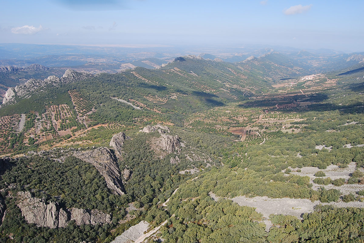
The Río Almonte anticline extends from the basin of the Tagus river, which limits it to the north, to the southern base of the Risco de La Villuerca, which constitutes its southern limit. The Almonte river itself flows through its core, and along part of its long course, from its source in the Risco de La Villuerca outcrops until it leaves it towards the Santa Lucía syncline, heading to the Apreturas del Almonte.

The CV-121 road runs almost parallel to the riverbed and is one of the main access routes through the villages of Roturas and Navezuelas, but there is also access via the road from Deleitosa to Robledollano and Castañar de Ibor.

ATTRACTIONS OF THE VISIT

During the visit we can take an illustrative tour that takes us through the different branches of Earth sciences, as well as other aspects such as ornithology, botany, ethnography or archaeology, but we will probably not have enough time if we only dedicate one day to enjoying such magnificent landscapes.

As far as geology is concerned, the first thing that stands out is its geomorphology, with impressive valleys and parallel sierras ravaged by erosion, characteristic forms of residual relief of the Appalachian type, and good examples of surficail hillside formations: scree, ejection cones, colluvium, hanging terraces, etc.

Stratigraphically, this megastructure contains a thick sedimentary succession of palaeontological interest, as its different rocks contain magnificent specimens of trace fossils. The tectonic structures present in the area provide good examples of the different types of deformation, both brittle and ductile, that have affected these materials, with faults and various types of folds.

Hydrogeology should not be forgotten, as the area has abundant sources or springs related to the different types of permeable lithology; for example, the source of the Almonte river in the potent spring that is located at the bottom of a huge rocky area, which acts as a recharge area for rainfall, located near the risco de La Villuerca.

This rich geodiversity offers the perfect habitat for a great diversity of living beings, especially the Mediterranean and riparian forests, home to a very remarkable bird life: griffon vultures, different species of eagles, black storks, etc.

GEOLOGICAL INTERPRETATION

The Río Almonte anticline is a northwest-southeast oriented folding megastructure originated by the compressive forces of the Variscan orogeny (approximately 300 Ma ago). This megastructure is a good example of an Appalachian-type relief, consisting of the outcrop of a narrow band of Ediacaran rocks between the more recent Ordovician materials (485-443 Ma), which constitute the Santa Lucía syncline and the Río Viejas syncline, located respectively to the west and east of this structure.

In the Río Almonte anticline we can find shales and greywackes of Ediacaran age that were deposited in deep marine environments (Domo Extremeño Group), and on top of which are, with an unconformity, materials of the Ibor Group, including shales, sandstones, conglomerates and limestones. In these materials there are abundant fossils of filaments of possible marine algae (vendotaenids), very characteristic of this group.

The Palaeozoic materials that outcrop on the flanks of the anticline correspond to sandy coastal sediments that generated the Lower Ordovician Armorican Quartzite, which were deposited on top of the previous rocks and today constitute, by differential erosion, the most outstanding reliefs in the area.