Geoparque Mundial UNESCO

Nº06 -Puertollano Fault

Geoparque Villuercas > Nº06 -Puertollano Fault

LOCATION AND ACCESS

The Puertollano fault is located between the towns of Cañamero and Guadalupe. It is easily reached by the EX-102 regional road at the junction with the EX-116 regional road from Guadalupe to Villanueva de la Serena.

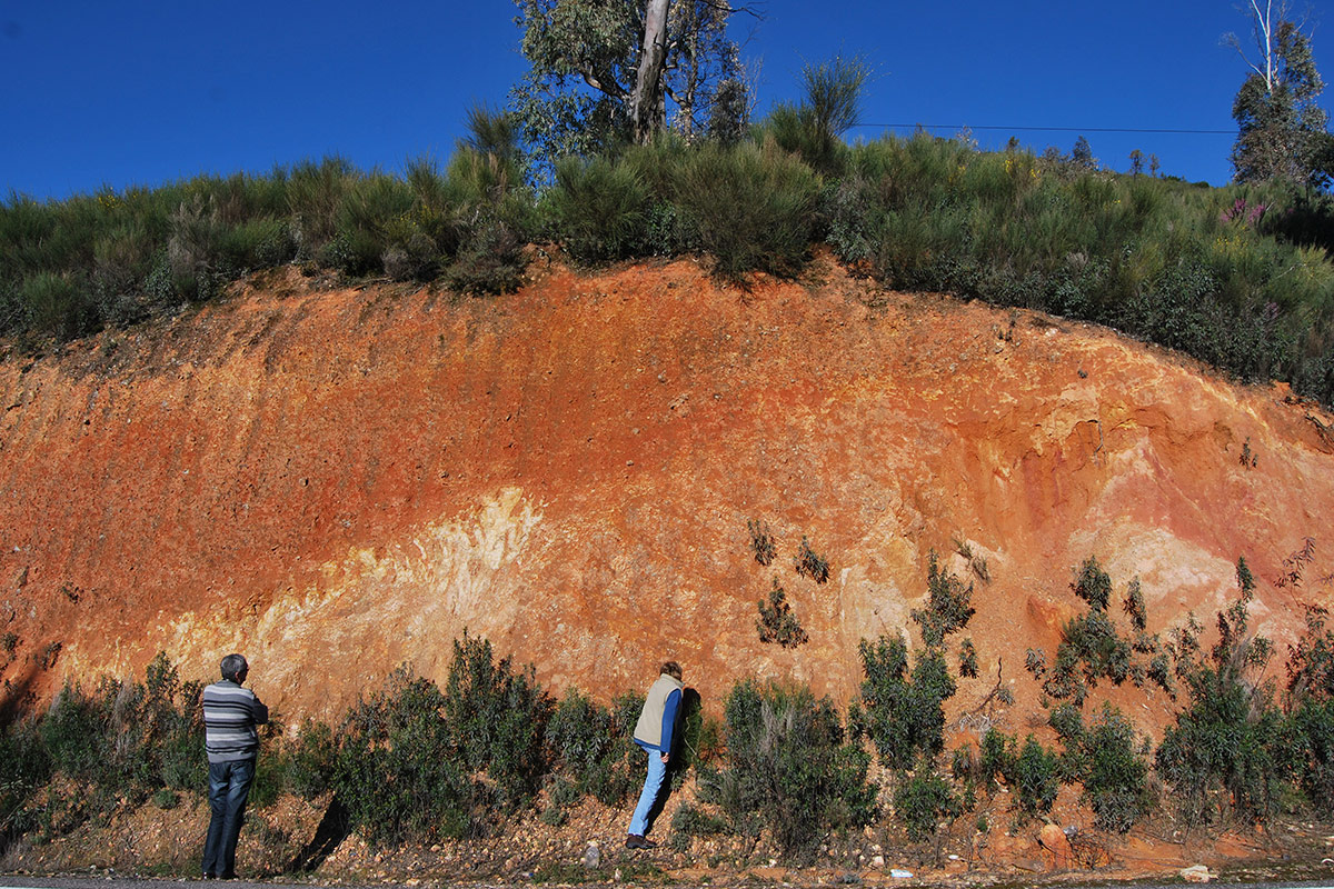
The fault is located parallel to the road and is partly covered by an extensive mantle of colluvium from the Sierra de Belén, where fragments of intensely crushed quartzite can be seen in a wide and deep mylonitic band.

As the area to be visited borders the road and in the middle of a bend, it is very dangerous to stay on the road and on the nearest hard shoulder. It is recommended to make the observation from the opposite side and off the road.

ATTRACTIONS OF THE VISIT

Recognise the fault with all its constituent elements, as well as the mylonitic zone in the Armorican Quartzite and its cover by a mantle of colluvium.

GEOLOGICAL INTERPRETATION

This large tectonic fault, transversal to the folding, has been interpreted in the Neotectonic and Seismotectonic map of the IGME as an Alpine normal fault with the block dipping to the southeast, and would form part of the set of normal faults that determined the uplift of the central block of Las Villuercas and the dipping of the marginal blocks to the north and south where the Neogene basins of the Tajo and Guadiana are located. Other interpretations (Gerardo de Vicente) consider it to be a reverse fault and even a thrust.

Originated during the Alpine orogeny, it determined the collapse of the extensive depression located to the south of Las Villuercas, which occupies the present-day Vegas Altas del Guadiana. This area constituted an endorheic basin in whose central areas there were lacustrine zones (such as the “Serenian Lake”) which were filled with clayey sediments in its central part, probably during the Lower-Middle Miocene and with warm and arid climatic conditions (See Geosite 5). With the rejuvenation of the relief due to alpine movements and conditions that caused this major fault, during the Late Miocene-Pliocene, the basin was filled with much coarser alluvial materials that included conglomerates with large blocks in the areas close to the reliefs, culminating in the deposit of the rañas (see Geosite no. 5: Raña de Cañamero).