Stratigraphic column: millions of years written in the rocks
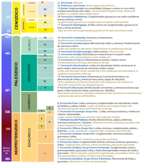
The Villuercas-Ibores-Jara UNESCO Global Geopark preserves, within its mountains and valleys, the traces of a geological history that stretches back hundreds of millions of years. Its stratigraphic column allows us to understand how this territory was formed and to uncover the sequence of materials and processes that gave rise to its extraordinary landscape.
The column represents the Geopark’s primary geological formations, arranged by age—from the oldest, dating back to the Precambrian, to the most recent deposits from the Cenozoic era. Each formation tells a part of this story: ancient marine sediments, sandstones, shales, quartzites, conglomerates, and other materials that, over time, were deposited, transformed, and deformed by geological processes.
This succession of rocks provides insight into the changes the territory has undergone—from the environments where sediments first accumulated to the tectonic movements and erosion that shaped the present-day mountain ranges and valleys. Many of these formations are essential to understanding the characteristic Appalachian-style relief of the Villuercas-Ibores-Jara region.
Ultimately, the stratigraphic column serves as a window into Earth’s past—a tool for interpreting the rocks and understanding why this Geopark represents a geological heritage of exceptional value.