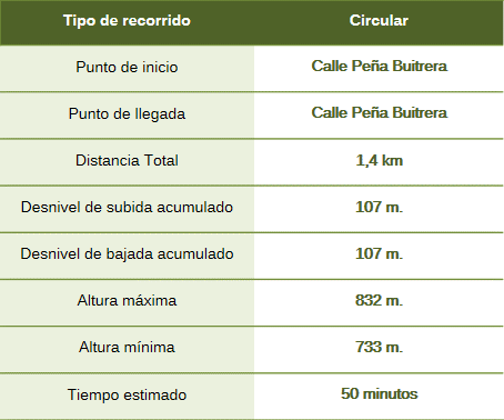
This short loop trail leads to Cabañas Castle, a fortification of Islamic origin dating back to the 12th-century Almohad period, which was later occupied by the religious military orders of the Knights of Trujillo and Calatrava. The castle stands atop an orthoquartzite ridge, and its layout is heavily dictated by the terrain; the structure is built of masonry using orthoquartzite rock sourced from local quarries. This fortress, which separates the Santa Lucía synclinal valley from the Trujillo peneplain, was part of a defensive network protecting the frontier of the Al-Andalus territories located south of the Tagus River.

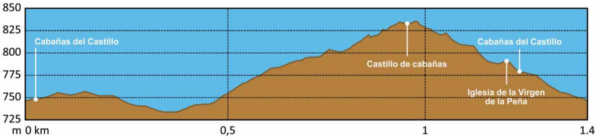
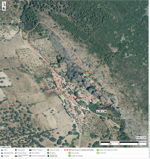
The route begins at the Cabañas car parks on Peña Buitrera Street and heads north along a path parallel to the mountain range. It continues until the vertical rocky ridge—upon which the castle stands—fades from view, leading into the *dehesa* (wooded pastureland). We take a path to the right, following the stone wall that runs alongside this section, to reach the base of the crags. The route then ascends via a trail to the castle’s old entrance, climbing up to the platform that offers views of the spectacular Santa Lucía syncline and the geopark’s characteristic Appalachian-style relief. From this viewpoint, one can see the mountain ranges of Ortijuela, Valdelaorden del Carabal, and La Venta, as well as Villuercas Peak and the Apreturas del Almonte gorge, among others. The descent follows the path leading from the southern small castle (*castillejo sur*), winding down through the layers of the Armorican Quartzite Formation to the Church of the Virgen de la Peña—a 15th-century structure built of local stone masonry and brick. From there, the route returns to the car parks.
Along the way, we may spot griffon vultures nesting on Peña Buitrera, short-toed snake eagles, Bonelli’s eagles, Egyptian vultures, and—with a bit of luck—black storks.
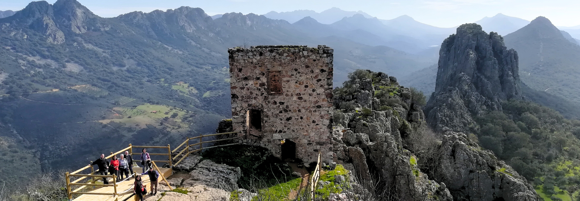
The route traverses the Santa Lucía synclinal valley—a large U-shaped fold located at the western edge of the Trujillo-Cáceres peneplain. It is an example of inverted relief: it forms a topographic high surrounded by anticlines (∩-shaped folds) that have since eroded away. It preserves rocks such as Ordovician and Silurian ortho-arenites and shales, representing a complete geological sequence spanning over 40 million years.
The summits are characterized by the Armorican Formation, which originated from sands deposited on shallow seabeds 470 million years ago. Although highly resistant to erosion, the formation was folded and fractured during the Variscan and Alpine orogenies. These structural processes have shaped the current landscape, creating the crags that define the ridgeline and the scree slopes visible along the valley sides.