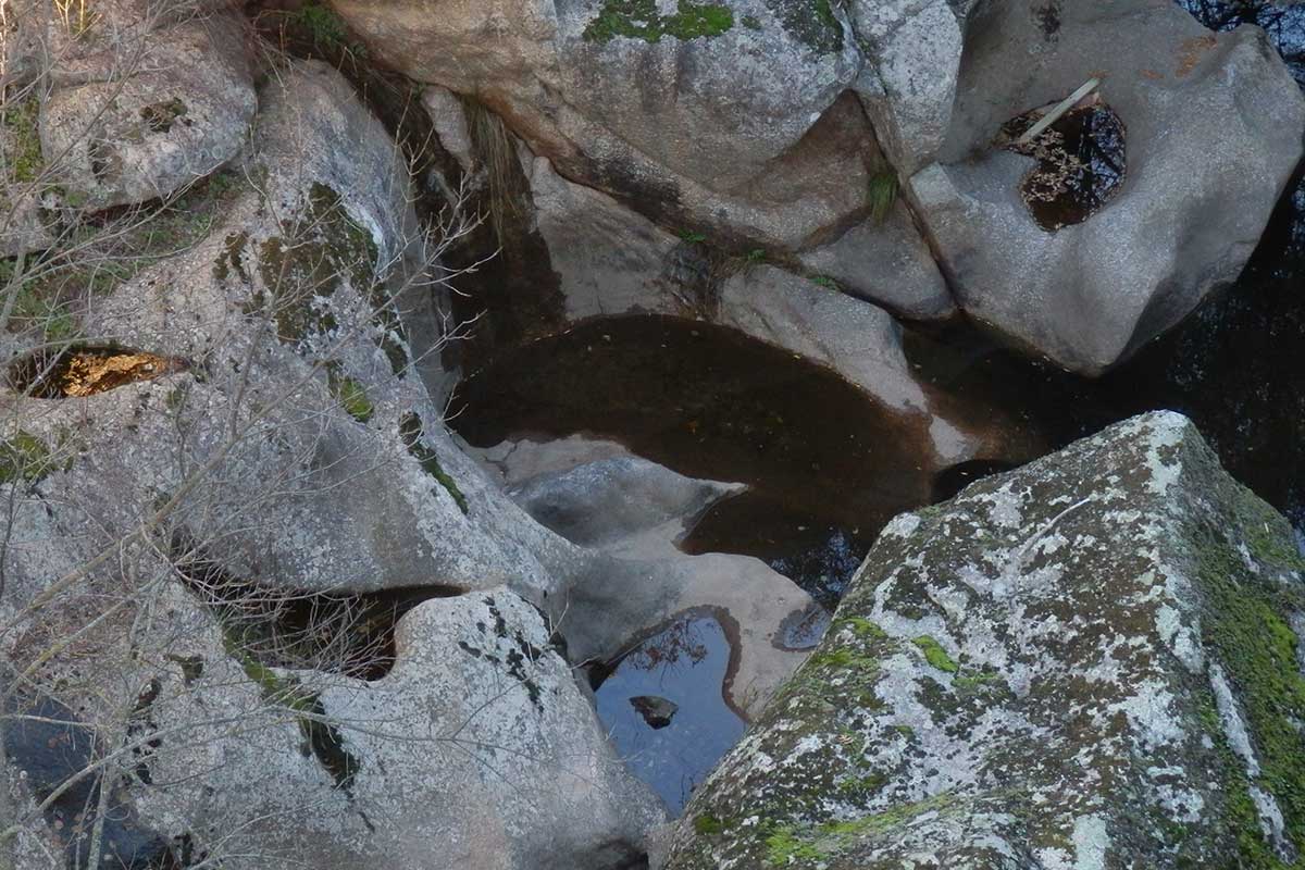
The geosite is located some 200 metres downstream from the old Mesteño bridge and explains very well one of the phenomena produced by fluvial erosion in the hard rocks found in riverbeds.
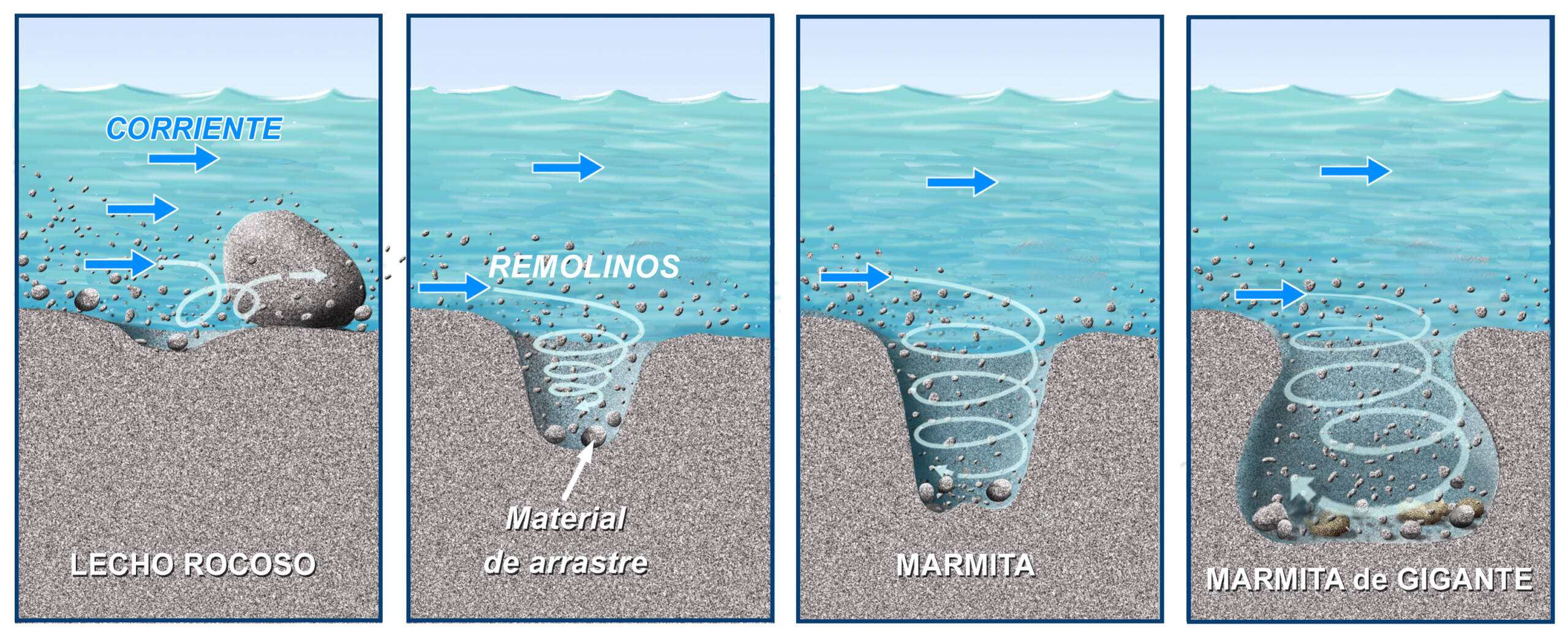
These are the so-called “marmitas de gigante” (giant’s kettles), an expression which, although it has that fanciful nuance, is a geological term that alludes to large, almost spherical concavities, caused by the erosive capacity of the river waters, favoured by the discontinuities of the river bed and by the solid material that they drag along during their transit through rocky areas. Locally they are called “pilones” or “pilancones”.
They are formed in riverbeds by the rotating action of very hard boulders when, dragged by the current, they fall into a small depression or concavity at the bottom of the riverbed. As the hard rocky fragments rotate in these concavities due to the movement of the water, they become worn and rounded, while their walls enlarge in width and depth, forming the ‘marmitas de gigantes’.
The hardness of the fragments must be similar to or greater than that of the rocks in which the concavity is formed. In this geosite, these are quartzite boulders transported by the Ibor river, and the rocks where the cavities are formed are porphyritic granites (granites with large crystals of orthoclase feldspar) highly fractured by orthogonal joints (horizontal and vertical fractures). The places where these fractures intersect may constitute the voids that favour the initiation of future ” marmitas de gigantes”. It is, therefore, a good example of intensive fluvial erosion caused by eddies, but there is also a certain tectonic influence (with the presence of joints) in its morphology and in its distribution along the channel.