LOCATION AND ACCESS
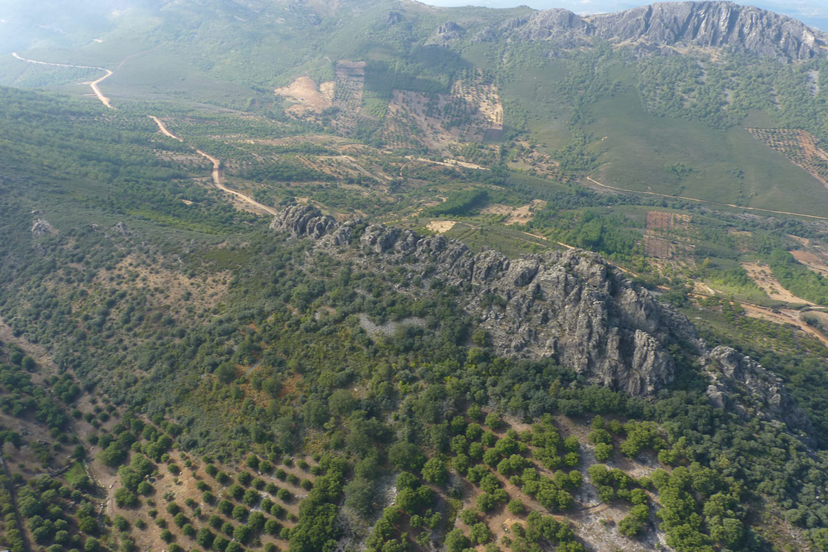
The Collado del Brazo is a col/saddle between the sierras, used for the old trails and modern roads to enter one of the wildest parts of the region. It is accessed by the CC-97 road that goes from Cañamero and Berzocana to Navezuelas. Between km 9 and 10 there is a slightly elevated area, with a gently curved profile, known as Collado del Brazo. It is elevated with respect to the extension of the valley both to the north and south, while to the east and west it is bordered by quartzite rock crests.
It marks the watershed between the Guadiana and Tagus river basins.
A landmark of this place is a traditional threshing floor known as the “Era del Gato” (Cat’s Threshing Floor) which, having lost its use, has been converted into a magnificent viewpoint.
ATTRACTIONS OF THE VISIT
The main objective of the visit is to observe the geomorphological features of the two valleys that start at this point. On reaching the Era del Gato threshing floor, the most relevant fact is that we are at the watershed between the basins of the Tagus and Guadiana rivers.
From here we can appreciate the characteristics of the Santa Lucía syncline to the north, at the bottom of which runs the Santa Lucía gorge, which is a tributary on the left bank of the Almonte river. The syncline extends towards the south, where the valley of the El Brazo ravine, a tributary of the Ruecas river, whose waters flow into the Guadiana river, is located.
We can also find magnificent examples of other frequent elements in different parts of the geopark, such as the rocky outcrops and colluvium that extend down from the Barrera de los Peñones and the Risco Gordo, the rock crests produced by the alternation of layers of different resistance to erosion and which emerge parallel to the mountain ranges.
We can also observe the layers of the successive sedimentary series, their fossils and the tectonic structures (folds and fractures) that are crossed in the outcrops created along the access road.
The wide landscape that can be seen from the “Era del Gato” and the viewpoint set up on the road make them privileged places for birdwatching. Furthermore, we are in the heart of the cave painting area of the Villuercan Chalcolithic and very close to historical sites such as the Castle of Cabañas and the Church of Berzocana (National Historical and Artistic Monument) which will complete an unforgettable day.