Geoparque Mundial UNESCO

Nº07 – Estrecho de la Peña Amarilla

Geoparque Villuercas > Nº07 – Estrecho de la Peña Amarilla

LOCATION AND ACCESS

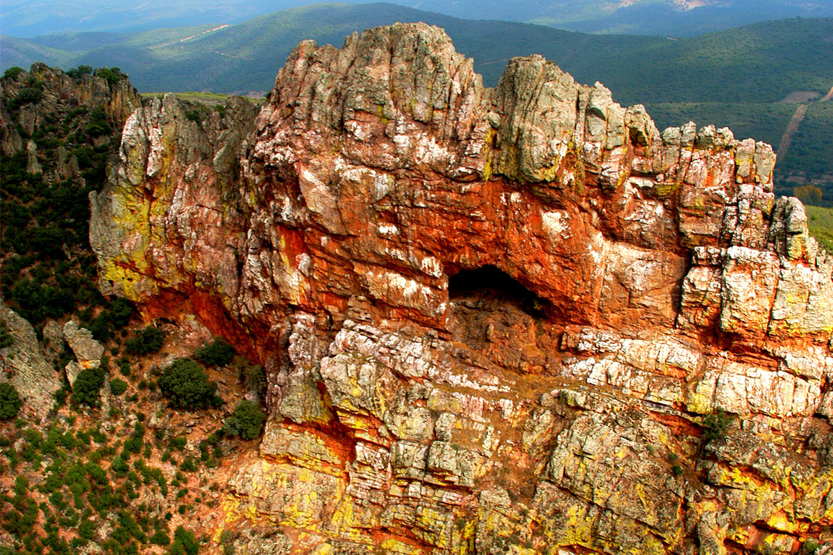
The Estrecho de la Peña Amarilla (Yellow Rock Defile) lies to the east of the village of Alía and can be reached by the EX-102 road at kilometre point 92.5 where there is a vantage point and parking area on the north side of the road. This defile, constitutes a natural boundary between the Sierra Palomera or western flank of the Guadarranque syncline and the shaley relief of the Ibor-Guadalupe anticline.

ATTRACTIONS OF THE VISIT

The visitor can observe not only the impressive geology of the outcropping of Armorican quartzites from the vantage point, but also fine examples of trilobite trails (Cruziana) in the road cuttings and on some transverse sections of these traces, which makes this geosite an outstanding paleontological location.

Attention should also be paid to the rock plant communities, which include in particular the characteristic bright yellow crustose líchen (Acarospora oxytona) that covers the rocky walls to give the Peña Amarilla its name. Examples of protected, threatened, or relict vegetation can be found (Portuguese laurel, junipers, etc.) and the contrast between the exuberant vegetation of the shady slopes and the more exposed vegetation of the sunny slopes can be appreciated. From this vantage point we can also observe the breeding colonies of griffon vultures together with a few isolated nests of Egyptian vultures and black storks, which make use of the vertical walls as nesting sites.

There is an interesting piece of history connected with this site; in the year 1133 King Alfonso VII of Castile travelled along the Roman road that crosses the Peña Amarilla defile towards Talavera on the way back from Al-Ándalus with his soldiers. Once the army had ended its campaign against the Arabs, it was thus returning via Seville: “Deinde rex movit castra et transivit illum Portum de Amarela et exivit in civitatem suam, quae dicitur Talavera”. (Luis Sánchez Belda, paragraph 42). Since then this old route has been known as the “Seville Road to Talavera” and it was used by the first Christian colonists who entered the district during the Reconquest.

GEOLOGICAL INTERPRETATION

These quartzite walls have their origin in the Lower-Middle Ordovician rocks (more than 470 million years ago), having undergone important tectonic movements, so that, despite being very compact and hard rocks, they are also very fragile and are highly broken up, with numerous rracturures. These fractures, unlike faults, have no displacement of the resulting blocks.

Ruptures along the stratification planes are the cause of numerous rock slides that have given rise to the striking caves and steep cliffs on the slopes of this gorge.

The Estrecho de la Peña is “a window between two worlds”: the Ediacaran-Lower Cambrian and the Ordovician, both separated by a prolonged period of emersion with continental deposits, followed in the Ordovician by a marine transgression. That is to say, the progressive advance of the seas over the land that emerged during the Cadomian orogeny (Ediacaran-Cambrian) making possible the new deposit of materials during the following periods, which, in turn, will later emerge when they are folded during the Variscan orogeny.

We can observe at the base of the gorge the shaly Ediacaran rocks, folded by the Cadomian orogeny, and above them conglomerates and quartzite rocks of the Ordovician, folded during the Variscan orogeny. In geological terms, this separation between strata of different nature and folded by different orogenies is called an angular and erosional unconformity.

In this geosite you can observe some of the most characteristic trace fossils (burrows, galleries, etc. left by ancient organisms that have not fossilised) of the Armorican Quartzite, especially Cruziana. They are attributed to traces of displacement – and probably feeding – of arthropods with appendages (legs) such as trilobites. These traces appear not only when the animal moved on the original surface, but also when it moved within the sediments. You can also see these interesting fossils at various places in the Geopark, but here they can be seen in cross-section (view), which is very rare.

The animal was burrowing into a layer with nutrients (mud in this case) and the upper layers (sand) were falling behind it, filling in and casting the excavation.