Geoparque Mundial UNESCO

Nº06 -Puerto Llano Fault

Geoparque Villuercas > Nº06 -Puerto Llano Fault

LOCATION AND ACCESS

The pass of Puerto Llano of Cañamero is located between the towns of Cañamero and Guadalupe. The local road EX-102 as far as the junction with the EX-116 gives easy access.

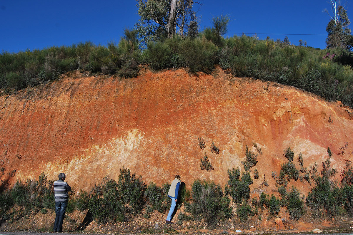
The fault is situated below a thick mantle of colluvium of the Sierra de Belén where the visitor can observe Armorican quartzites that have been strongly crushed along a wide and deep mylonitic strip. As the area to be visited is very near the road and right on a bend, it is dangerous to stop there and on the adjacent verge. It is best to observe the fault from the opposite verge away from the road.

ATTRACTIONS OF THE VISIT

Recognising the fault with all its elements, together with the mylonitic area in the Armorican quartzites and its covering layer of colluvium.

The works of an abandoned railway line can be seen in the vicinity. The trace, width, and depth of this fault cannot have been taken into account during the project of the railway line that was to run from Villanueva de la Serena to Talavera de la Reina. A long tunnel of 1363 m was to cross the fractured Armorican quartzites of the Sierra de Belén from east to west at Puerto Llano on the eastern flank of the wide Ruecas syncline. The greatest drawback of this route was the rugged relief and the hardness of the quartzite rocks of the sierra, together with the crushed and mylonitic area of this great fault. This prompted the decision to abandon definitively all work on the line, as the Puerto Llano tunnel had been affected by several dangerous landslides because it was hard to brace it given the methods of the time. These setbacks justified the total abandonment of the railway project by a Ministerial order of 22nd September 1962.

GEOLOGICAL INTERPRETATION

This large tectonic fault, transversal to the folding, has been interpreted in the Neotectonic and Seismotectonic map of the IGME as an Alpine normal fault with the block dipping to the southeast, and would form part of the set of normal faults that determined the uplift of the central block of Las Villuercas and the dipping of the marginal blocks to the north and south where the Neogene basins of the Tajo and Guadiana are located. Other interpretations (Gerardo de Vicente) consider it to be a reverse fault and even a thrust.

Originated during the Alpine orogeny, it determined the collapse of the extensive depression located to the south of Las Villuercas, which occupies the present-day Vegas Altas del Guadiana. This area constituted an endorheic basin in whose central areas there were lacustrine zones (such as the “Serenian Lake”) which were filled with clayey sediments in its central part, probably during the Lower-Middle Miocene and with warm and arid climatic conditions (See Geosite 5). With the rejuvenation of the relief due to alpine movements and conditions that caused this major fault, during the Late Miocene-Pliocene, the basin was filled with much coarser alluvial materials that included conglomerates with large blocks in the areas close to the reliefs, culminating in the deposit of the rañas (see Geosite no. 5: Raña de Cañamero).