San Cristóbal Hill is composed of a granitic pluton from the Variscan Orogeny. It rises dome-shaped (approximately 200 meters above the Ediacaran peneplain, which is composed of greywackes, shales, and conglomerates), due to intense differential erosion, highlighting its geomorphological significance.
Associated with this granite, they are some series of mineral deposits with a history of mining dating from the Bronze Age to recent times. They preserve a heritage that, together with scientific dissemination, reinforces the educational value of this site.
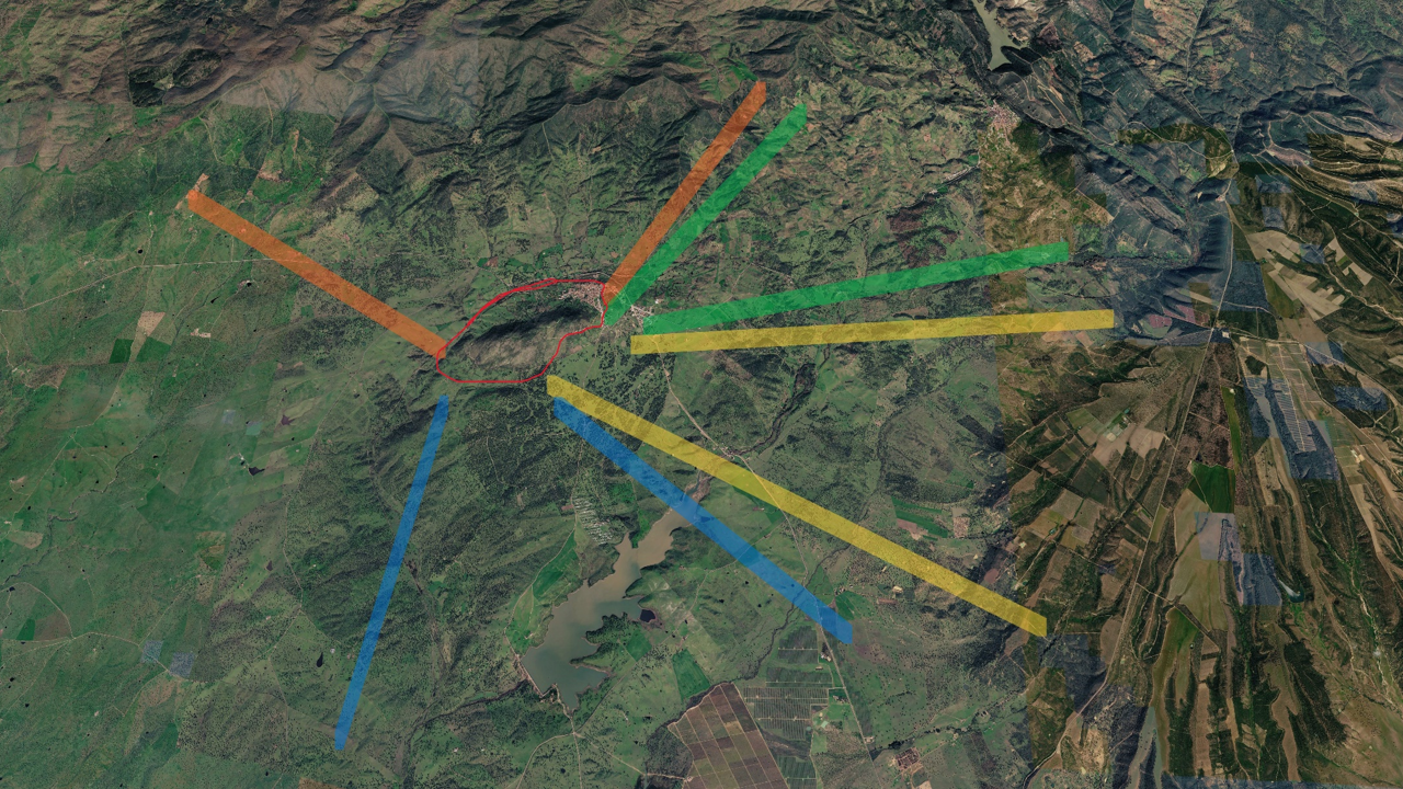
RELIEF
From the summit of San Cristóbal Hill, several important geomorphological units can be distinguished in the landscape, depending on the direction of observation.
Panoramic view to the north (orange band)
To the north, the Sierra de Guadalupe can be seen, known in geology as the Garciaz block, which represents the division of the basement and the uplift of the block located to the north above the Ediacaran peneplain. This process took place during the later stages of the Alpine Orogeny.
Panoramic view towards the northeast (green band)
In this direction, the impressive Appalachian relief is visible, marked by the ridges of Paleozoic quartzite rocks, with their characteristic NW-SE orientation.
Panoramic view towards the southeast (yellow band)
On the horizon, a geomorphology of extensive platforms or plateaus separated by erosional channels, known as Rañas, can be observed. These were formed by the accumulation of relatively recent sediments from the Appalachian relief located to the north.
Panoramic view towards the south (blue band)
To the south, a relief that gradually softens until it becomes horizontal can be seen, formed by the Cenozoic and Quaternary sediments that fill the Guadiana basin.