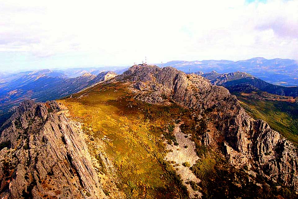
La Villuerca, at 1601 meters elevation, is the highest peak of the geopark’s mountain system. It is part of the southeastern periclinal termination of a set of tight NW-SE directed variscan folds; from east to west, the Rio Viejas syncline, two narrow synclines less than 1 km wide (whose fold axes run close to La Villuerca and La Villuerca Chica) and the Santa Lucia syncline. These synclines are separated by their corresponding anticlines. The first, partially dismantled to the south, shows its Ediacaran core in the Collado de la Celada and its hinge (displaced by several faults) extends along the high peaks of the La Tejadilla and Alta mountain ranges. It is one of the few examples in the geopark of a narrow anticlinal hinge that has not been totally dismantled by erosion. Between the La Villuerca and Villuerca Chica synclines there is a narrow anticline whose hinge follows the direction of the source of the Almonte river and is lost under the rocks. In its dismantled core we find the Ediacaran basement materials covered by spectacular scree, associated with the source of the Almonte (Geosite11). Finally, we have the Almonte anticline.
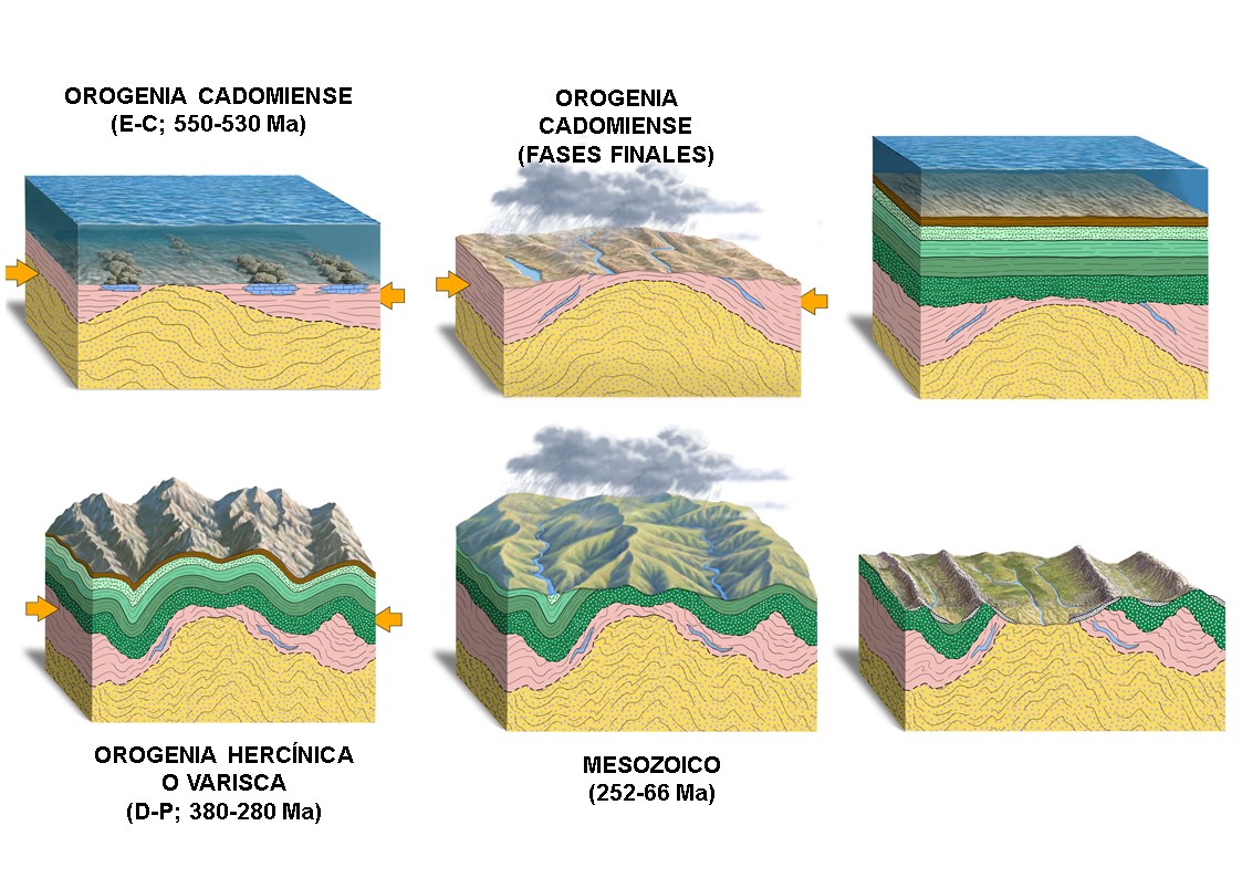
Folded during the Variscan orogeny (between 370 and 300 million years ago), the Paleozoic materials emerged from the seabed forming part of an important and high mountain range that has been subjected to erosive processes ever since its formation, which have shaped the typical geomorphology of inverted reliefs, with dismantled anticlines showing in its core the folded materials during the Cadomian orogeny (Ediacaran-Lower Cambrian).
The important lithological contrast between the basal Ordovician materials, highly resistant to erosion and permeable by fracturing (Armorican Quartzite), and the Ediacaran materials, mainly shales and greywackes, poorly permeable and very friable, has favoured a strongly differential erosion, with the Ediacaran materials of the core of the dismantled anticlines occupying the lower areas of the valleys, with soft reliefs, and the Paleozoic materials of the quartzite flanks the highest areas of the terrain (inverted relief).
The Variscan orogeny, together with the rejuvenation of the relief during the Alpine orogenic movement, has configured the main geomorphological characteristic of the region, which is in the form of a succession of elongated anticlines and synclines that in the structure of the orogens is known as “zone of folds and mantles”, and “Appalachian-type relief” in geomorphological terminology (by similarity with the forms found in the Appalachian Mountains of North America).
However, it must be taken into account that the Appalachian-type relief is only a geomorphological concept, since the Ordovician-Silurian geological materials of the Appalachians consist of carbonate rocks that were deposited in areas close to the equator in the Laurentia paleocontinent, and so are very different from the siliceous rocks of the Villuercas-Ibores-Jara UNESCO World Geopark, with its characteristic Armorican Quartzite formations that outline the relief exclusively linked to the Variscan domain and with a paleogeographic situation close to the south pole.
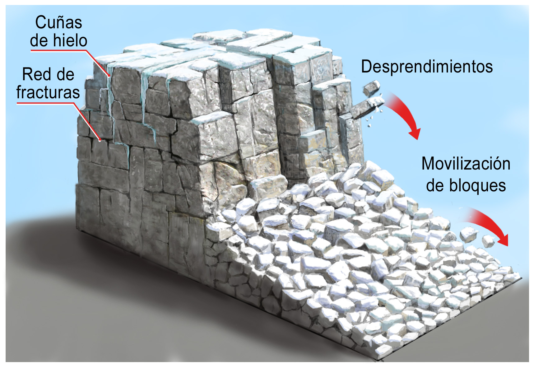
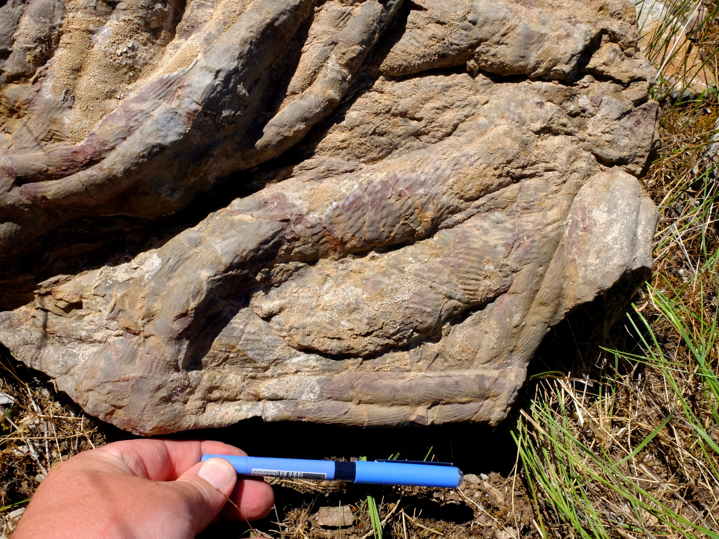
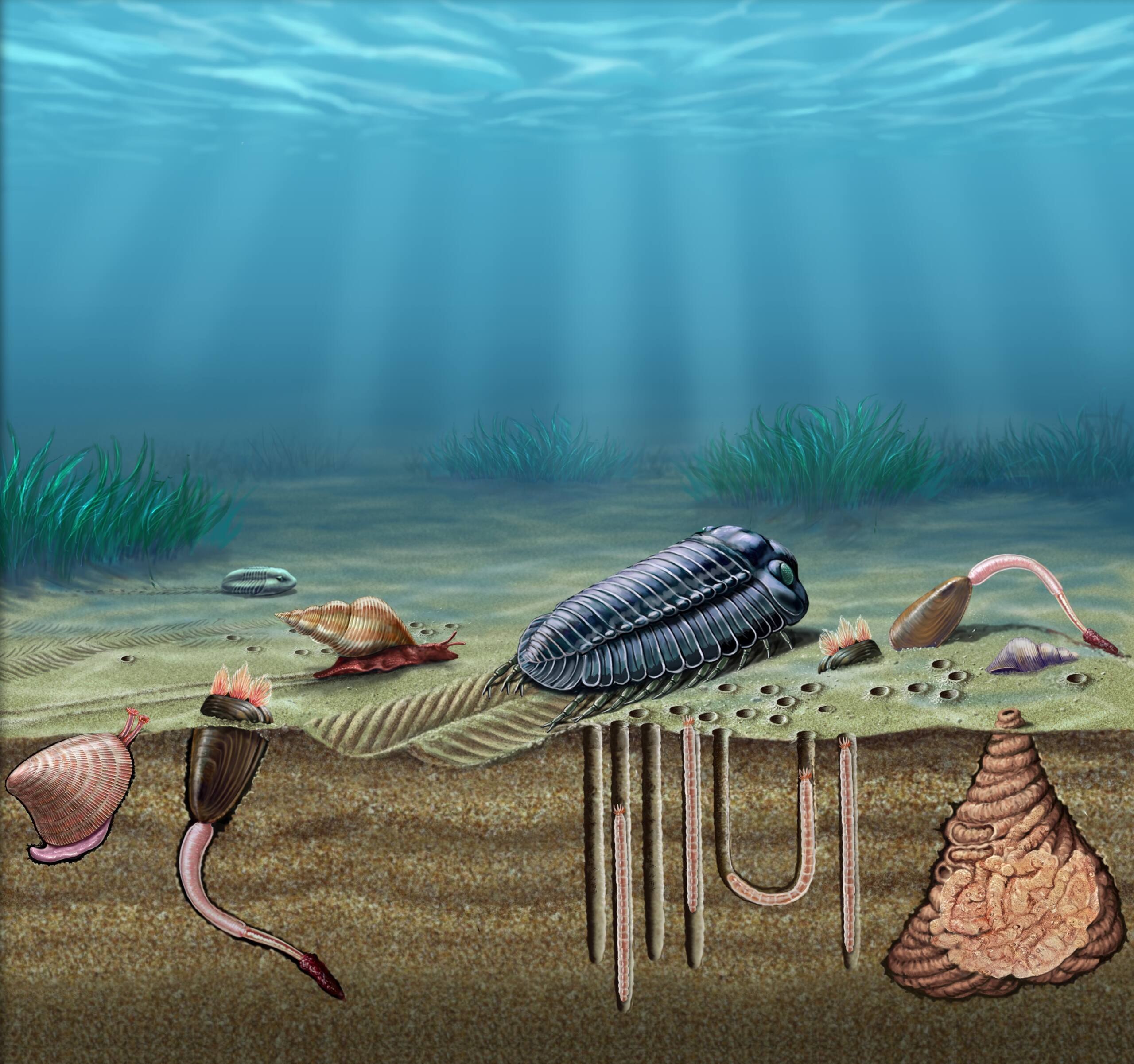
On the steep slopes have been deposited by gravity a large amount of quartzite debris, disintegrated by mechanical weathering (gelivation). These are known as “pedreras”. The Armorican Quartzite includes abundant trilobite trace fossils (Cruziana) and galleries formed by soft-bodied organisms, known as Skolithos and Daedalus, which allow dating these rocks to the Lower-Middle Ordovician.
Figure captions:
Formation of boulders from the strongly diaclastic Armorican Quartzite, by cryofracture and gravity. Illustration by Antonio Grajera.
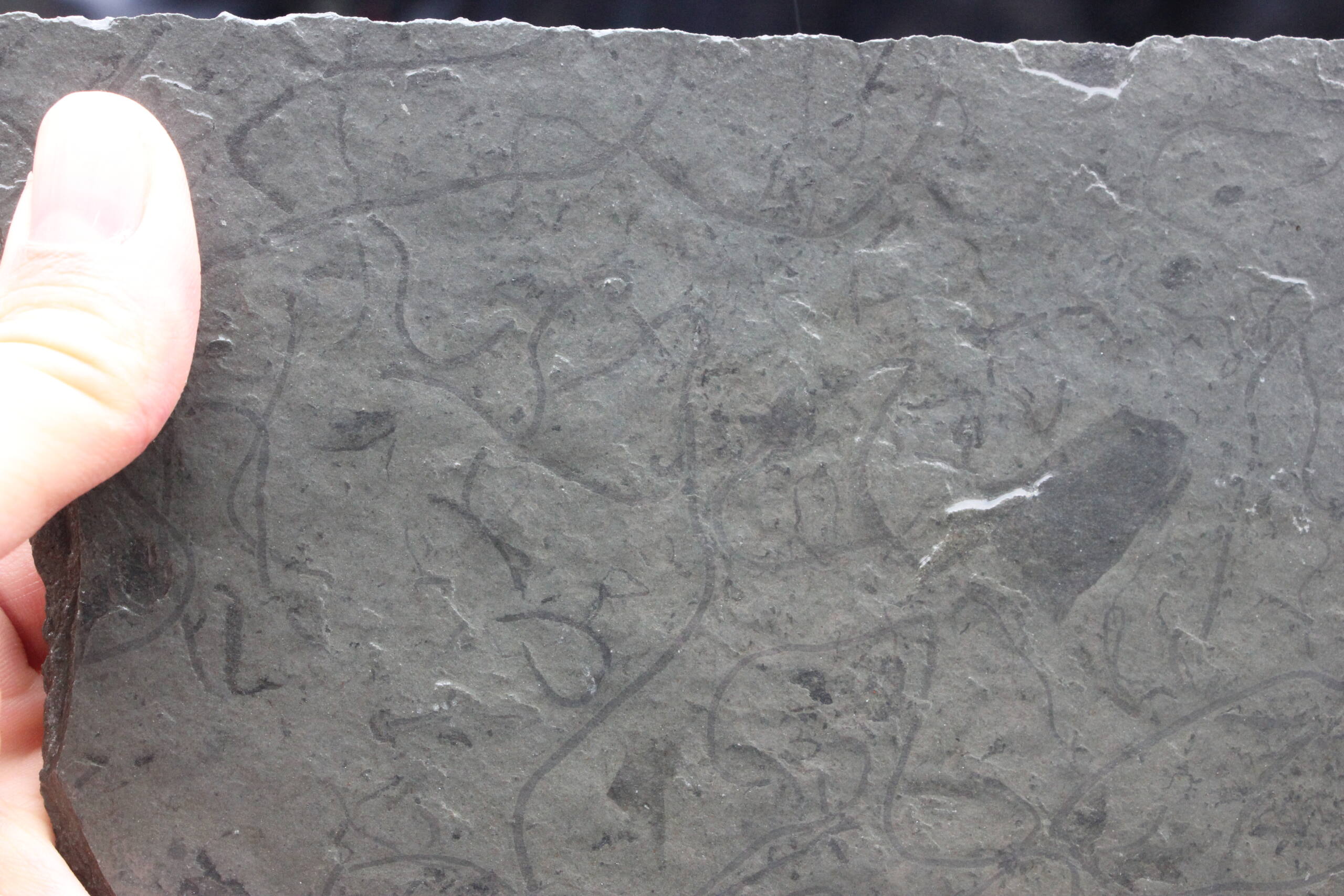
Sample with vendotaenids.
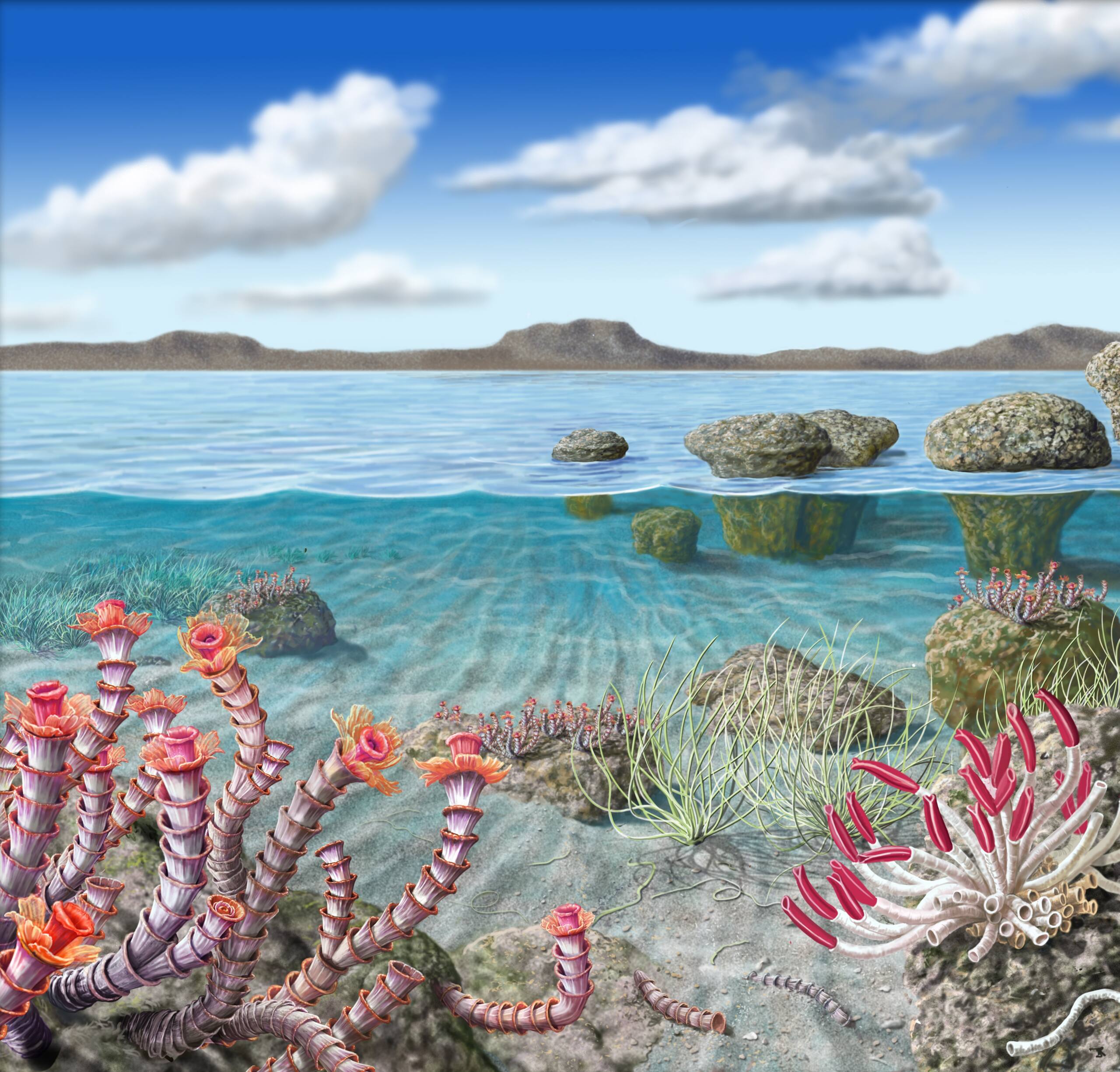
Reconstruction of the Ediacaran ecosystem in the geopark. Illustration by Antonio Grajera.
Cruziana from Pozo de la Nieve area.
Most common trace fossils of the Armorican Quartzite. From left to right: Cruziana, Skolithos and Daedalus. Illustration by Antonio Grajera.
