16-THE FUERTE DE CASTROS OF VILLAR DEL PEDROSO

Geoparque Villuercas > CULTURAL SITES > 16-THE FUERTE DE CASTROS OF VILLAR DEL PEDROSO

During the Córdoba caliphate a series of defensive structures were raised for the purpose of halting the Christian advance south of the River Tajo. This strip of territory was called Marca Media or At-Tagr al-Awsat. The territory of the Villuercas-Ibores-Jara Global Geopark of the UNESCO was part of this frontier land and the Fuerte de Castros is one of the fortresses, the remains of which have survived to this day.

Where the Pedroso Stream flows into the Tajo is an impressive spot both because of the waterfall of the last section of the tributary and the surrounding landscape. Here on a hill located between the Pedroso Stream and the Tajo to dominate a strategic enclave stands the Fuerte de Castros. It is a citadel around which extended an Arab settlement attracted by its protection.

Its origins date back to the 10th and 11th centuries; its construction may have been ordered by Abderraman II in the year 918. Despite this, the qualifier ‘del Castro’ leads us to think that it was previously occupied by a pre-Roman settlement. This fortress was part of the defence system of La Jara and together with the castles of Gualija and Espejel watched over the frontier of the Tajo.
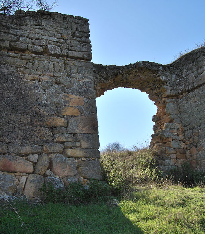
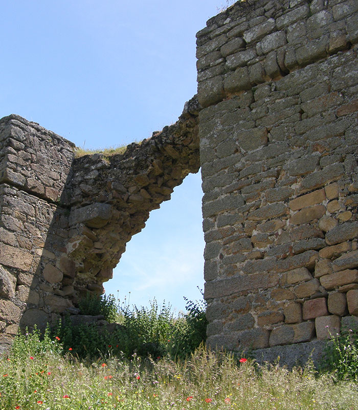
Its location was not only chosen for the protection afforded by the natural relief of the landscape but also in order to defend an old bridge which used to exist over the Tajo. The visitor can still observe remains of two cutwaters (pillars which divide the waters to distribute them below the spans of bridges) of this construction, which was of considerable size and a vital point for crossing the river.

Nowadays we can observe two towers of the fortress either side of the entrance to the enclosure; they are built of granite masonry. In its interior the mark of the quadrangular cistern can be seen; this was an essential structure in this type of castle which needed a water supply in case of a siege. The remains of a large tower, probably the keep, can also be seen. The ground plan of the citadel extends over the small plateau (created by levelling) on the steep hill. It follows a model widely used in Al-Andalus which consists of a rectangle of square towers adapted to the height of the location.

The remains of the settlement surround the walled enclosure; remains of the walls of the houses can be observed. These had a rectangular ground plan and were small in size. According to the chronicles, after the Reconquest and the Christian occupation of the valleys of the Tajo the site was permanently abandoned.