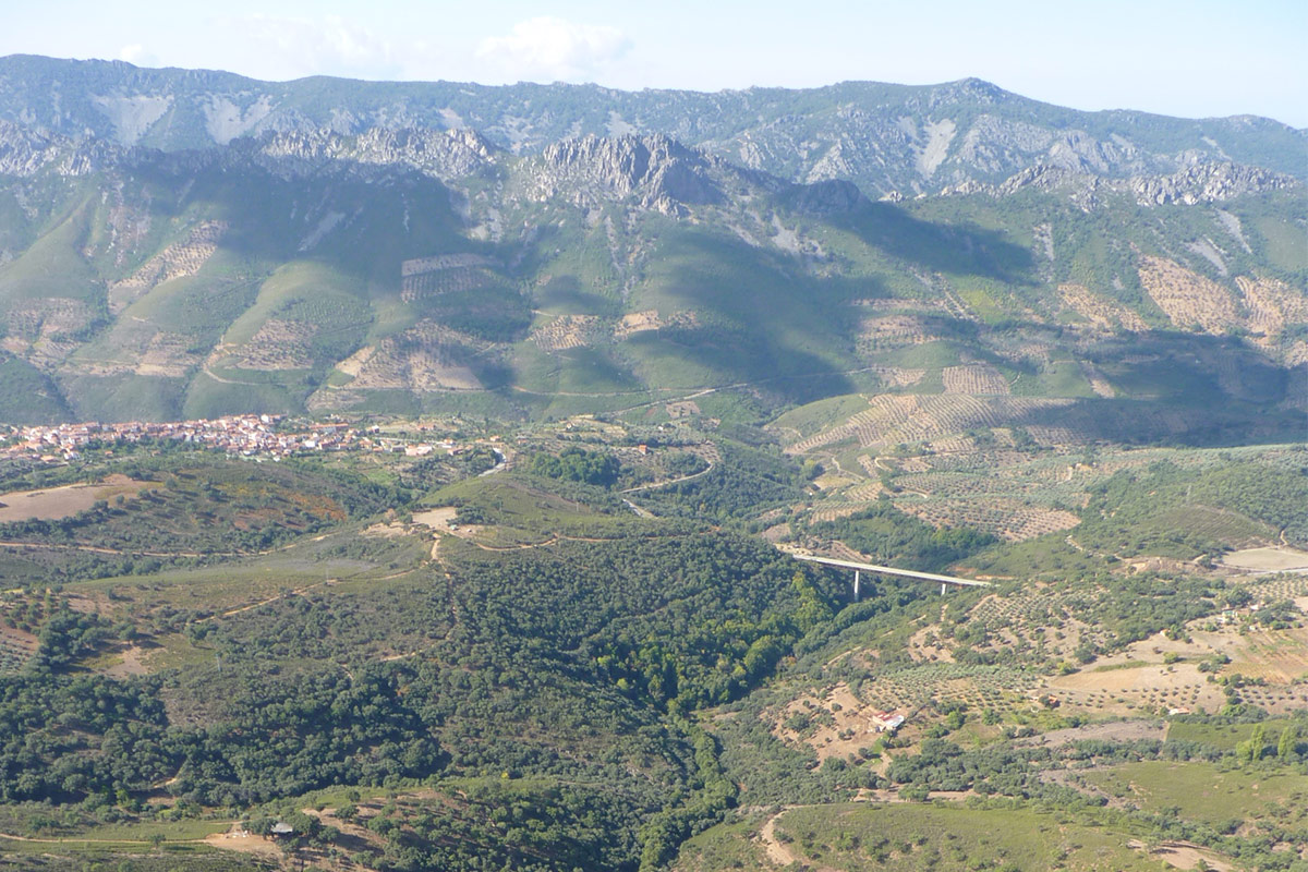
Geologically, it must have been a very extensive and elongated folding structure in a NW-SE direction, but its almost total dismantling by erosion prevents us from reconstructing its original shape. Today, we can only observe a few remnant hills in its narrowest part near Navalvillar and Castañar de Ibor, where it possibly formed an anticlinal structure. However, in its widest part, near the Alía-Guadalupe crossroads, it is most likely to have been a succession of small anticlines and synclines of which there are still some small witness hills, such as the Pico Agudo or the small outcrops to the north of the Puerto Llano strait. The erosive dismantling of this megastructure formed during the Variscan orogeny, which occurred during the Carboniferous Period, more than 300 million years ago, shows us the Ediacaran basement rocks folded during the Cadomian Orogeny, some 540 Ma ago, and whose structural directions do not coincide with the Variscan ones.
From the chosen observation site, it is easier to understand that the rocks (Armorican Quartzite) that form the ridges of the sierras on both sides of this megastructure are part of the same geological formation that once formed a large anticline or anticlinorium. What we see today are its remains because the entire core of the vaulted megastructure has disappeared, becoming a valley (inverted relief) crossed by the Ibor and Guadalupe rivers, leaving only part of its flanks or edges (e.g. the Castañar and Navalvillar mountain crests).
The materials that appear in the core of the exhumed anticlne are the oldest in the geopark and belong to the Domo Extremeño Group, of an imprecise Ediacaran age, as it contains no fossils. The Domo Extremeño Group, represented here by the Guadiana Formation, is a highly monotonous and thick series (more than 10.000 metres) of alternating shales and greywackes that were deposited by turbidites in deep marine environments. They represent flysch sediments related to the Cadomian orogeny. The greywackes, with an important clayey matrix, and the presence of abundant organic matter and pyrite (both in the greywackes and in the shales) allow for easy weathering and erosion, so that this unit produces smooth and depressed reliefs. These materials, widely represented in a hypothetical triangle with a vertex at the Humilladero hermitage and bases in the municipalities of Guadalupe and Alía, are interrupted to the south by the extensive Tertiary deposits of the rañas. The ease with which these rocks are altered makes it difficult to observe them, being the areas where works have been carried out (such as road embankments and abandoned railways) the most favourable.
In angular and erosive discordance, observable in several areas, the Domo Extremeño Group is overlain by the Ibor Group, widely represented in the narrowest part of the structure (Ibor valley) and in the margins close to the great megastructure. It includes a great diversity of detrital sedimentary rocks (shales, feldspathic sandstones, greywackes and conglomerates) and chemical precipitation rocks (discontinuous carbonate levels that can reach more than 100 metres in thickness). All these sediments were deposited in a mixed platform environment (siliciclastic and carbonate).
The most remarkable feature is the presence in the carbonate levels of the first metazoans that secreted a calcareous exoskeleton (Cloudina and Sinotubulites). Cloudina, together with Sinotubulites, Namacalathus and other skeletal fossils from the late Ediacaran, are the precursors of the generalised biomineralisation that occurred in animals at the beginning of the Cambrian, favouring new feeding and defence strategies that allowed the colonisation of new environments. Undoubtedly, the origin of skeletons led to a strong expansion of the marine fauna that has been recorded in the fossil record as a major evolutionary event known as “the Cambrian explosion”.