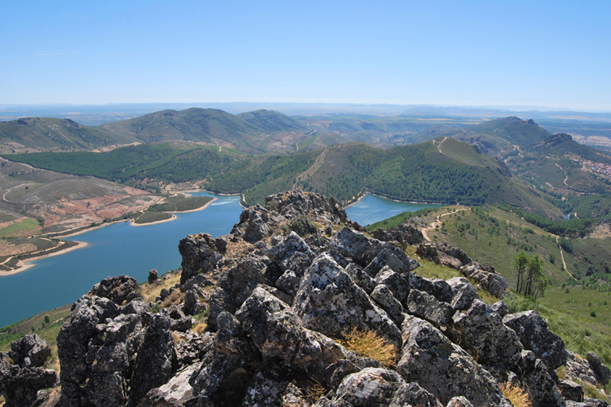
The crests of the Sierra de La Madrila form the extension of the Cañamero anticline. We can observe the potent, almost vertical strata of the Armorican Quartzite and, above them, there are other strata of quartzite of lesser thickness with intercalations of lutites where ichnofossils are beginning to be abundant.
The Armorican Quartzite is a geological formation that was defined in France in the Armorican Massif (Grés Armoricain), but its translation into English as “Armorican Quartzite” gives rise to some confusion. A quartzite is defined as a siliceous metamorphic rock; however, much of the material actually corresponds to siliceous sandstones very rich in quartz (≥90 %), so the appropriate term to identify these rocks would be quartz-sandstones. They are derived from very mature, washed siliceous sands that had formed on beaches and shallow subtidal environments during the Ordovician period.
As the Ordovician transgression progressed, the sea level rose and environments appeared in which the sands were interspersed with shaly materials typical of silty bottoms, less washed by the strong waves and with abundant nutrients. Here, communities of benthic organisms proliferated, as evidenced by the presence of abundant ichnofossils that represent the activity of these communities, with those produced by trilobites (Cruziana) being very characteristic and spectacular.
These rocks are located on the western flank of the broad Santa Lucía syncline affected by two tight folds (see Geosites 9, 10 and 12). The Armorican Quartzite is quite fractured, which allows the infiltration and accumulation of precipitation water until it is subsequently drained through the abundant Fuente de La Madrila (La Madrila spring), located on the western slope of the sierra, close to the faulted contact between the base of the Armorican Quartzite, highly permeable due to fracturing, and the Ediacaran rocks, with a low permeability. This spring supplied the nearby village of Cañamero with water during the 1930s and 60s.
From the risco Viejo (Viejo crag), located in this same sierra, we can see a formidable panoramic view to the west, with the wide and monotonous peneplain of Ediacaran rocks (shales and greywackes); the raised block of Garciaz (of the same nature), the granitic stock of the Cerro de San Cristóbal, in Logrosán. To the east we can see the Ruecas river syncline, with the Cancho del Fresno dam and reservoir; and to the south, in the distance, the sedimentary platforms that make up the Cañamero and Logrosán rañas.