Geoparque Mundial UNESCO

Nº12 – Ruecas River Defile

Geoparque Villuercas > Nº12 – Ruecas River Defile

LOCATION AND ACCESS

The Ruecas river flows for about two kilometres to the north-east of the village of Cañamero, through a deep gorge flanked by the high quartzite crests of the Los Castillejos and La Lóriga Sierras, and the Castillo and Las Cuevas crags. Halfway along the route, it is joined by the waters of the Valbellido stream, which drains one of the most fertile valleys in the municipality.

The Ruecas river flows from the Cancho del Fresno dam to the beginning of the fertile plain of Huertos del Río. The vastness of the site means that it can be reached by different routes: by the road from Cañamero to Guadalupe, which runs parallel to the river; by the old Berzocana road, which also leads to the aforementioned dam and the natural pools; and by the path that takes us to the Álvarez (or La Chiquita) cave. The gorge can also be reached from the La Jarilla neighbourhood, located in the highest part of the town centre, along the Camino Natural de Las Villuercas (Las Villuercas Nature Trail).

ATTRACTIONS OF THE VISIT

In addition to the beauty of the landscape of the Cañamero anticline and the Ruecas river, we can also visit its rock shelters, including the Álvarez cave or Chiquita cave, the Rosa cave, the Vencejos shelter, etc…, which were occupied temporarily, as places of refuge and sanctuary, in the Chalcolithic period (around 3,500 years ago). Here our ancestors made numerous schematic cave paintings, in reddish and black colours, with stylised figures of men and animals, astral signs, stripes and dots, etc.

The physical conditions of the river bed also helped the establishment of Chalcolithic settlements and, during the Reconquest, the construction of the impregnable Muslim castle of Cañamero, where the armies of the León prince Sancho Fernández were stationed in 1220. Likewise, since the Middle Ages, numerous flour mills have been built in the narrow valley in order to take advantage of the driving force of the waters of the Ruecas. Some of them have curious legends related to the Cruzianas “engraved” in the quartzite of the riverbed (e.g. in the vicinity of the Charco de la Nutria – the Otter pool).

We can also visit the Interpretation Centre of the ZEPA (Special Protection Areas for Birds) of the Sierra de Las Villuercas and the Guadarranque valley, located very close to the “Cancho del Fresno” dam. The Geopark Visitor Reception Centre is located in the village of Cañamero, where there are panels and a documentary on the origin of all the geological formations in the region, as well as a selection of characteristic rocks, minerals and fossils, models, maps and photos of the most significant geosites.

GEOLOGICAL INTERPRETATION
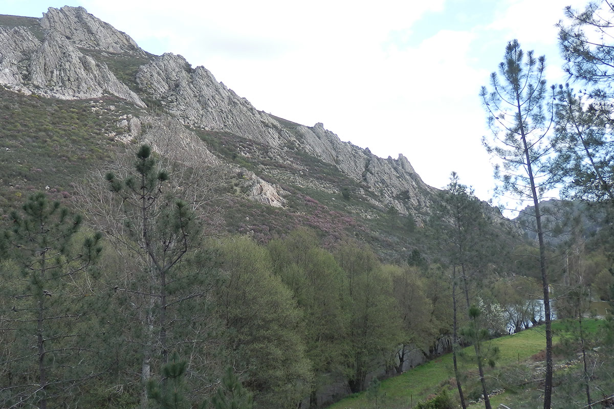
The Ruecas river is embedded in the hard Armorican Quartzite in a direction parallel to the strata, which have an excellent exposure in this area, and runs along the axis of a narrow folding structure: the Cañamero anticline which extends to the Cancho del Reloj (Geosite 9). Its location close to the southern periclinal closure of the Villuercas synclinorium, means that the Armorican Quartzite has numerous folds, easily observable, which are manifested by narrow synclines and anticlines in a situation very similar to that observed in the La Villuerca crag.

The wide valley formed in the Santa Lucía syncline, through which the river flows upstream of this fluvial channel, is followed by a narrow anticlinal structure, completely dismantled by erosion, but its folded quartzite strata can be observed at the end of the gorge in the nearby Las Cuevas cliff.

The Armorican Quartzite has an excellent exposure, allowing the observation of its folding structures. From a stratigraphic point of view, there are numerous trace fossils (Cruziana, Skolithos) showing the activity of Palaeozoic marine animal and striking sedimentary structures produced by waves (ripple marks).