Geoparque Mundial UNESCO

Nº09 – Cancho del Reloj

Geoparque Villuercas > Nº09 – Cancho del Reloj

LOCATION AND ACCESS

Access is afforded by the road from Berzocana to Solana, and then by a forest track that leads to the stream known as the Garganta de Santa Lucía: continue on the path to the right that will take you to the top of the Sierra del Castillejo.

ATTRACTIONS OF THE VISIT

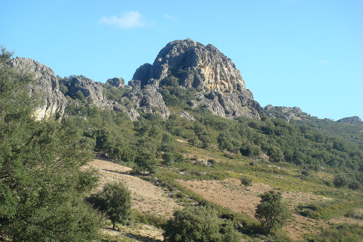
Observation of the relief: Vertical strata of Armorican quartzite, the Santa Lucía synclinethe Trujillo peneplain, strike-slip faults, the narrow anticline of the sierra, etc.

Observation of raptors: The quartzite outcrops provide birds of prey with safe nesting places in the form of narrow ledges from which they fall into the void in search of a thermal to lift them: griffon vultures, eagles, Egyptian vultures, kestrels, and other raptors frequent these inaccessible crests.

Observation of archaeological remains: The particular geographical circumstances of this sierra have encouraged the development of human communities since antiquity, as is shown by the wealth of remains left by the ancient inhabitants of the area. On the path up to the summit the remains of the walls of a medieval settlement can be seen, and on the top a watch-tower built of stone and mortar.

This sierra also contains various sets of schematic cave paintings from the prehistoric period known as the Chalcolithic. Representations of human figures (ancoriformes) can be distinguished and also dots and parallel traces (tectiformes) in ochre tones arranged on the smooth surfaces of the quartzite strata facing the west.

GEOLOGICAL INTERPRETATION

The so-called “Cancho del Reloj” of Solana de Cabañas is an impressive outcrop of almost vertical quartzite strata (“Armorican quartzite”) which correspond to the western flank of the great Santa Lucía-Río Ruecas syncline. This outcrop gives rise to the Sierra del Castillejo to the southeast of the village, the name of which refers to the remains of the Arab castle on its heights.

The strata of quartzite rocks produce these solid outcrops or projections owing to their greater competence (hardness and resistance to erosion) than the other rocks and shales and sandstones that surround them, which are also due to the rectilinear orientation and verticality of their layers in a northwest-southeast direction.

This process of flattening by differential erosion (a difference in erosion owing to the various levels of hardness of the strata) can be appreciated in the landscape that unfolds towards the northwest, which is where the shaley Trujillo-Cáceres peneplain extends.

Stratigraphically the Armorican quartzites constitute a wide layer of some 200 m that can be followed for long distances over much of the sierras of Las Villuercas, Monfragüe, Cañaveral, etc. They date from the Lower Ordovician (480 million years ago) and represent sedimentation in marine coastal environments and shallow littorals, such as a beach of fine siliceous sand beaten by the waves where trilobites have left their characteristic traces (Cruziana) on these rocks.