LOCATION AND ACCESS
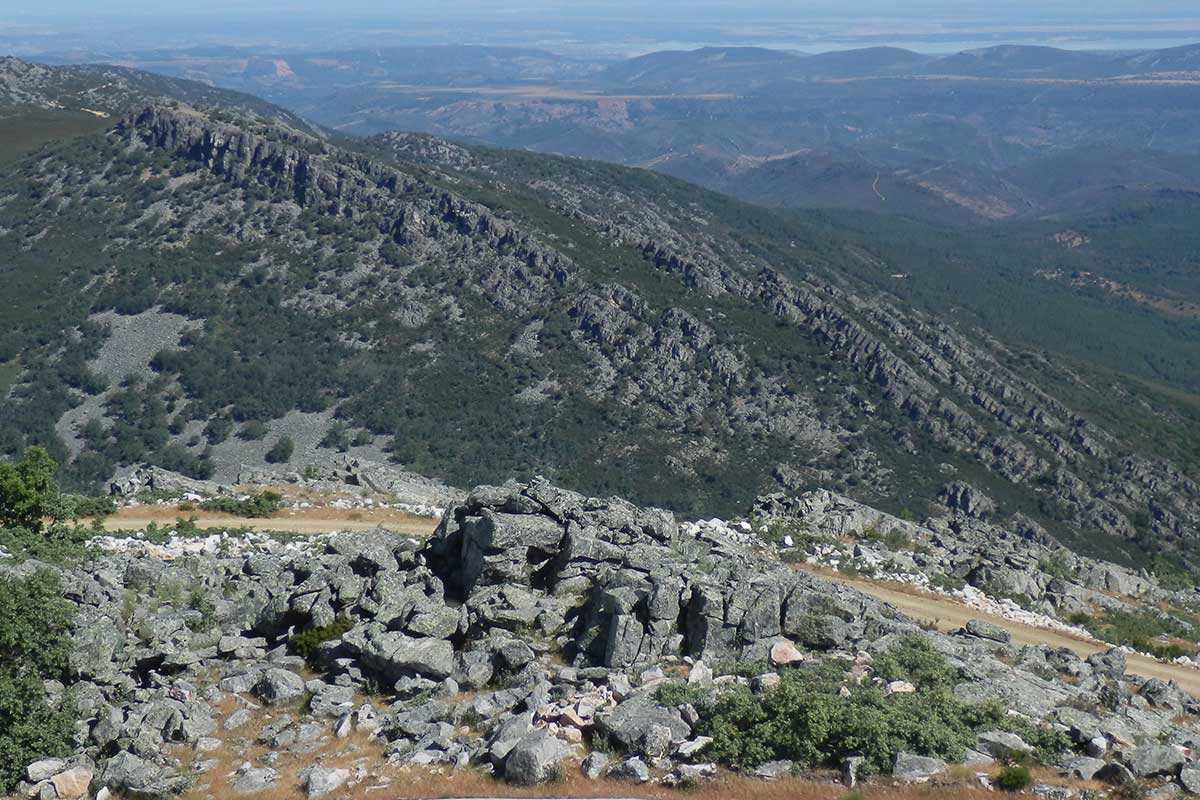
At km 31.5 of the CC-20 road that runs from Guadalupe to Navatrasierra and some 2 km from the historical Hospital del Obispo, we can observe on our left a set of Armorican quartzite strata known as the Canchos del Ataque.
Geoparque Mundial UNESCO
Geoparque Villuercas > Nº30 – Canchos del Ataque
At km 31.5 of the CC-20 road that runs from Guadalupe to Navatrasierra and some 2 km from the historical Hospital del Obispo, we can observe on our left a set of Armorican quartzite strata known as the Canchos del Ataque.
Observing different aspects of the geological macrostructures, in this case of the Guadarranque syncline and the Ibor-Guadalupe anticline, such as the fold flank or a part of the hinge (“witness hill” of the Camorro). We can find in the valley the peat bogs described in Geosite 26, and can observe in the vicinity the pedrera known as the “Melonar de los Frailes” in an allusion to the large size of its stones.
Downstream the brook has magnificent riverside woodland with alder, ash, holly, Portuguese laurel, etc. On its banks on the route to the Castañarejo there are several examples of centenary chestnut trees. In the flowering season specimens of albino Spanish lavender can be identified.
The site includes some interesting and significant historical and cultural aspects. The royal road or the Camino Real from Castile to Guadalupe passes this way with its essential stopover point at the historical Hospital del Obispo, which was built for the benefit of pilgrims on their Marian route towards the Monasterio de Guadalupe.

The continuity of the sierra of the Hospital del Obispo is broken through the Sierra del Rullo by the transverse course of the river known as the Garganta del Hospital del Obispo. At the “Canchos del Ataque” (the “apretura” or defile that is formed by the Garganta del Hospital del Obispo when it crosses the sierra of the same name) the strata of Armorican quartzite from the Lower Ordovician with an approximate inclination (dip) of 45º E can be seen. What these strata represent is part of the transition flank of the Guadarranque syncline to the east and the Ibor-Guadalupe anticline to the west. This is a site where the elements of an anticlinal fold can be observed (see these parts in the geological cross-section).
As from this point and all along the way as far as the hamlet of the Hospital del Obispo we can observe on the summits on both sides (the shady side and the sunny side) of the stream the extension of the aforementioned quartzite strata to make up part of the hinge (the highest part of a fold) of the Ibor-Guadalupe anticline. Further to the west can be seen a “witness hill” known as the Camorro de Navalvillar, a residual relief form sculpted by the erosion of this hinge or cupola of the great Ibor-Guadalupe anticline. This route also features the Geosite “Peat Bogs and Trampales of the Hospital del Obispo”.
All the rocky formations of Las Villuercas are intensely fractured; this is especially visible and significant in the quartzite alignments. The continuity of these formations is interrupted by more or less transverse displacements caused by faults. The Garganta del Hospital del Obispo forms a subsequent fluvial channel (rivers that follow a fault) as a tributary of the River Gualija, as in these cases the faults are manifested as incisions that are deep enough for the channels to abandon their habitual course and join or be captured by a larger watercourse.
