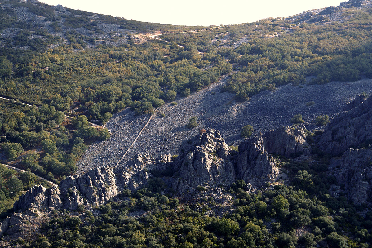
The Almonte river is one of the most important tributaries of the Tagus river in Extremadura on its left bank. The source of the river is linked to a large rocky outcrop, a chaotic deposit of large blocks with angular and irregular shapes. Rainwater easily filters through these rocky blocks until it finds a less permeable layer, such as the shales of the hillside, and flows into the interior of the talus slope, finally emerging on the surface in the form of a spring at the foot of the block slope.
The water channelled through the Armorican Quartzite, which is a highly permeable unit as it is very fractured, also makes a very important contribution. The base of the Armorican Quartzite contacts with the impermeable Ediacaran materials (shales and greywackes), channelling all the water it collects in the high sierras following the synclinal structures that act as channels.
The talus slopes (“pedreras” locally “casqueras”) are widespread on all the slopes of Las Villuercas, and are always found below the quartzite crests, which constitute their “source area”. Geologically speaking, they are slope landslides, but when the rock fragments that make up the rocky slopes are several cubic metres in size they are also called talus slopes.
The origin of these blocks is related to the characteristics of the Lower Ordovician (480 Ma) Armorican Quartzite visible in the ridges of the mountain ranges. These rocks are very hard, but have been folded and fractured by the action of the numerous transverse faults that “cut” the mountain ranges. These fractures are called joints. These fractures facilitate the appearance of other smaller fractures and the separation of the different blocks originated by a mechanical weathering process known as the “ice wedge effect”: water enters the fractures and, as it freezes, widens them, fragmenting the quartzites. Along these fractures, the quartzite outcrops begin to slowly disintegrate, forming large blocks that break away from the cliffs under the effect of gravity.
The blocks fall over the base of the quartzite ridge and the underlying Ediacaran rocks, depending on their weight and slope, they slide or roll down the slope. When the block deposits are arranged on a steep slope, they are very unstable and new secondary movements occur. As a final result, these deposits form outcrop with slopes of up to 20% and a variable thickness that can exceed 5 metres.
At present, the blocks are covered by lichens and no landslides are observed, which indicates a certain stability and also that the talus slops cannot have been generated recently. It is very likely that they were formed under cold and rainy climatic conditions, typical of Pleistocene periglacial climates (1.8 Ma-10.000 years ago).

